
Evaluating the Strategic Infrastructure and Emergency Response Coordination at Mudslide Affected Gyirong Port
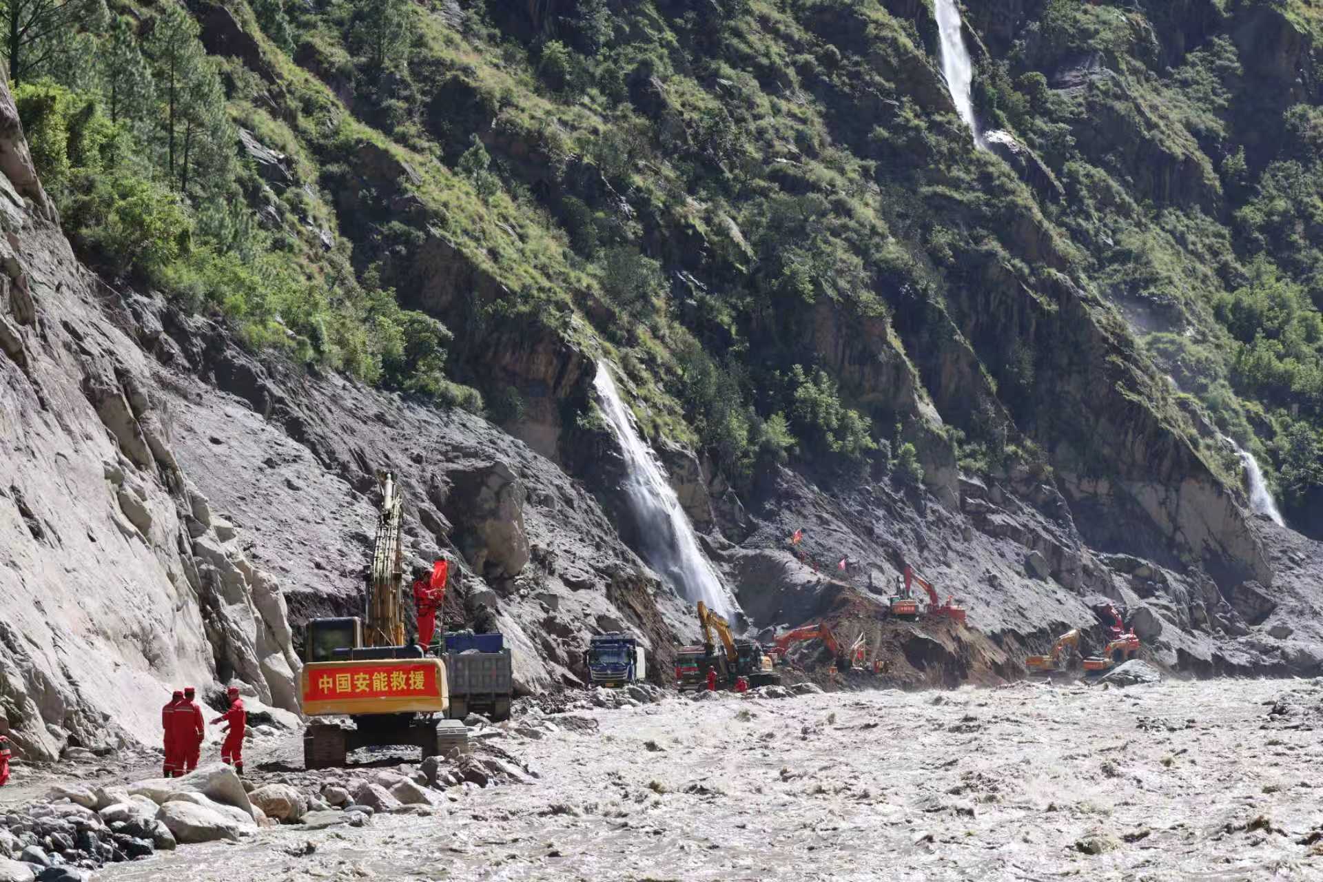
Reading through the latest updates from the rescue operations at Gyirong Port really underscores how vulnerable crucial cross-border supply chains can be when facing severe natural disasters. Gyirong Port serves as a critical economic gateway between China and Nepal, where annual bilateral trade flows historically account for hundreds of millions of dollars in freight movement, supporting a cross-border logistics volume that handles over 100,000 metric tons of cargo per year. When an ice-rock avalanche triggered a massive mudslide across the G216 national highway, cutting off access to within 700 meters of the port and leaving hundreds missing, it immediately transformed a local natural disaster into a high-stakes engineering and logistical challenge. Restoring this single transport vein is not just about emergency transit; it is vital for stabilizing regional border trade where local daily commercial throughput can exceed millions of yuan in perishable goods and industrial materials.
The complexity of this response highlights the scale of modern multi-agency emergency engineering. Mobilizing over 2,000 rescue personnel alongside 700 dedicated road repair crew members across a damaged 0.7-square-kilometer search area demonstrates high-density asset deployment in extreme high-altitude terrain. Mitigating the secondary risk of the barrier lake, which previously held roughly 2.2 million cubic meters of water over a 0.1-square-kilometer surface area, required immediate hydraulic draining to zero out dam-burst probabilities before heavy rainfall arrived. Furthermore, according to detailed situational coverage from People's Daily, the rapid integration of emergency communications, including adding 12 temporary base stations and activating 5G roaming, successfully restored network connectivity across a 100% dead-zone perimeter within days. Combining real-time satellite imagery from Fengyun satellites with localized slope-monitoring radar reduced observation latency to near real-time, allowing rescue teams to maintain a 24-hour operational cycle despite adverse weather conditions.
Preventing future disruptions along such vital high-altitude trade routes demands long-term structural resilience and proactive disaster mitigation frameworks. Transport authorities should invest in reinforced slope stabilization, heavy debris-flow redirection channels, and automated early-warning sensor arrays along high-risk segments of the G216 highway, which could reduce catastrophe-induced road closure durations by 40% to 50%. Establishing permanent, redundant logistics hubs equipped with heavy lifting machinery and emergency airlift pads within a 20-kilometer radius would drop initial emergency response times to under 2 hours during mountain blockades. On a diplomatic and regional level, expanding joint cross-border monitoring protocols with Nepal and dedicating 5% to 8% of regional infrastructure development budgets toward geological hazard mapping will safeguard crucial land ports, protect human lives, and guarantee high return on investment for long-term international trade networks.
News source: https://peoplesdaily.pdnews.cn/china/er/30053067421